

It’s African American History month and Trout in the Classroom students are celebrating the black women and men in STEM fields that have contributed valuable research supporting our efforts to take care of the environment. One such hero is mathematician Dr. Gladys West. Dr. West who, in the 1970s and 80s, developed algorithms, incorporating gravitational, tidal and other forces that distort earth’s shape, to create an accurate model of the planet. Dr. West’s important research ultimately became the basis for the Global Positioning System (GPS) that we use for so many applications.
In our Virtual Think Tank, the cold temps, brought by the polar vortex, seem to be make our brookies want to hunker down between the gravel and stay almost completely still. Their body temperatures drop as the tank water temperatures drops, and their metabolism slows down to an essential minimum. In streams, this response to low temperatures helps trout survive longer without food as they seek refuge downstream to quiet, slow waters or in deep pools and beaver ponds.
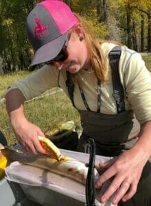
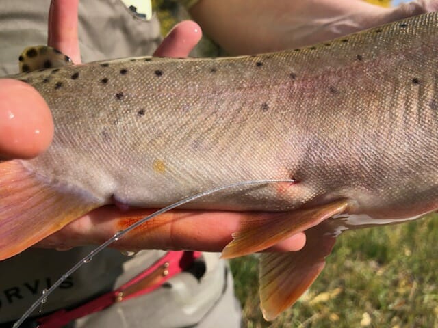
Biologists can learn about the winter migration of the trout and other animals by tracking them using various forms of transmitters. In New York, TU scientists Tracy Brown and Caroline Shafer, are using Passive Integrated Transponders, or PIT tags, to monitor trout location and migration in our local streams. PIT tags have a microchip that is identified by a special antenna and computer. These tools help our scientists track wild vs. hatchery raised fish, monitor interactions, identify fish barriers, and understand seasonal migrations. Trout Unlimited staff use a variety of tracking methods, include radio telemetry tags.
For larger animals, such as mammals and birds, monitoring via GPS helps provide even more precise migration data. GPS uses forms of satellite trilateration to pinpoint more exact locations on a map, a more advanced form of tracking compared to PIT tags that are limited by antennae placements. Although this type of tracking is not yet available for trout, we hope that in the future GPS data can tell us how to help trout by improving their habitat, connecting streams, and prioritizing restoration work. GPS and other tracking methods allow us to make better decisions when it comes to wildlife management and care. The future of trout research is bright and Trout Unlimited is excited to be a part of it.
Science Journal Question for TIC Students: What are some ways that you use GPS in your daily life? How do you think GPS will help us in the future?
Hands-on STEM for 3-12: The Future with Trout Trilateration
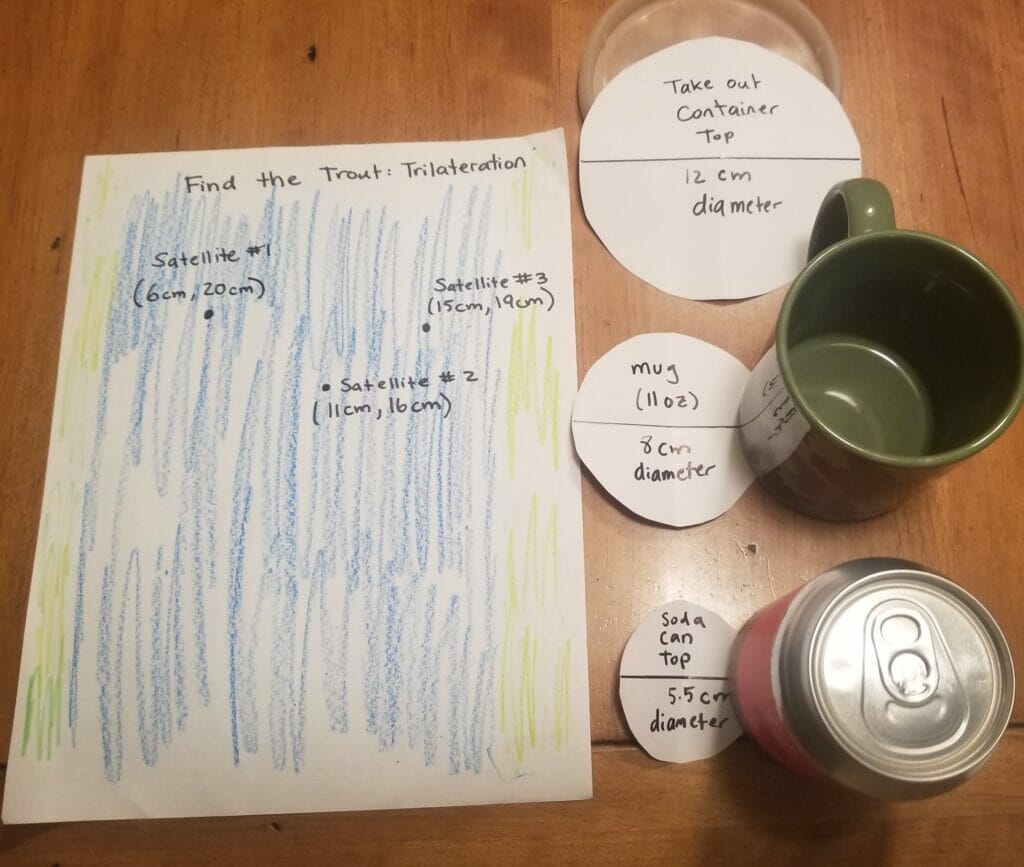
1) Have a 8.5” x 11” paper in the vertical orientation, this will be your stream!
2) Measuring from left to right (for the X-axis) and then bottom to top (for the Y -axis) draw three points for Satellite #1 (6cm, 20cm), Satellite #2 ( 11cm, 16cm) and Satellite #3 (15cm, 19cm).
3) Use paper or cardboard to cut out circles in the following sizes: For Satellite #1 cut out a 8cm diameter circle (or trace the bottom of coffee mug), for Satellite #2 cut out a 5.5cm circle (or trace the top of a soda can), and for Satellite #3 cut out a 12cm circle (or trace the top for a takeout container).
4) Find the center of each circle and poke a hole to align them with the correct satellite on the stream and trace the three satellite circle.
5) Draw a picture of your fish at the point where all three satellite waves intersect. You located your trout using trilateration!
Dive Even Deeper: Why is GPS tracking for trout not yet available? How could this type of research help scientists, especially trout bilogists, in the future?
More STEM for 6-12: Engineering and Triangulation: How to find the way using triangulation
Family Science: Geocaching is a fun and interactive way to learn about GPS, navigation, and trilateration all while exploring new outdoor spaces and looking for “treasure”. Download the free App or create your own treasure hunt in your yard or neighborhood using GPS coordinated to hide and locate hidden prizes.