
Critical Minerals Report
Special Places
Below are some of the country’s most unique landscapes that encompass, or exist near, known critical mineral deposits. As you read, please consider our tenets to see how they can avoid and mitigate impacts to irreplaceable natural resources while supporting responsible critical minerals mining.

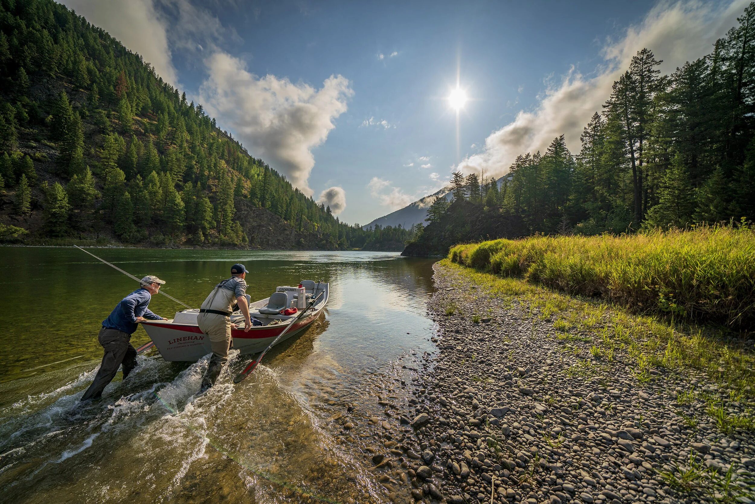
Boundary Waters, Minnesota
Straddling the border between northern Minnesota and Canada, the Boundary Waters Canoe Area Wilderness is America’s most visited wilderness area. It contains 20 percent of the National Forest System’s fresh water, welcomes a quarter of a million annual visitors and supports 12,600 regional jobs. It was one of the nation’s first designated wilderness areas, and one of the first areas to benefit from a permanent mining ban within its borders.
The region was once covered by massive sheets of glacial ice that advanced and retreated over thousands of years. They receded about 12,000 years ago, scraping away chunks of earth and leaving behind an endlessly complex network of streams, rivers and channels connecting hundreds of lakes. Some of the oldest rocks in North America, created about 2.7 billion years ago, rest near the surface. The native lake trout populations inhabiting the deeper lakes are a unique part of our natural heritage.

One could spend a lifetime navigating and exploring the area’s lakes and islands, all the while fishing for record walleye, northern pike, lake trout, muskie and bass, and listening to a wolf howl at dusk and loons mournfully cry in the morning. For a millennia, hunters and anglers have shared the banks of the Boundary Waters with black bears, moose and Canada lynx in a wildness that’s becoming increasingly rare.
Just outside the wilderness area, however, the Boundary Waters’ watershed is being targeted for a potentially dangerous, sulfide-ore-bearing copper mine that could produce cobalt and platinum group metals – critical minerals. Should the mine be developed, the Boundary Waters – which is located downstream – could be permanently harmed. Therefore, the conclusion is clear. It’s simply the wrong mine in the wrong place.
Here’s why:
Multiple science-based studies determined that pollution, including acid mine drainage, from sulfide-ore copper mine runoff is almost certain, and its negative impacts would be intensified because of the area’s complex hydrology. The Boundary Waters geology lacks limestone and other pH-buffering rocks that could otherwise help safeguard against the creation of acid mine drainage. Once contaminated, it would be virtually impossible to cleanup and restore the lakes and rivers of the Boundary Waters.

A Harvard University study from 2018 estimated that between 260-650 temporary mining jobs would be created for the 20-year operating life of the copper mine, while 4,400-6,600 of the existing 12,600 jobs in tourism and outdoor recreation in the watershed could be permanently lost. Additionally, absent a mine, the study predicts the area would add 1,500-4,600 more jobs and up to $900 million more in personal income over the same 20-year period. Quite simply, by permanently withdrawing the Boundary Waters watershed from potential mining, the region’s tourism and outdoor recreation economy will continue to thrive and the resource will exist as it is today for future generations.
In his autobiography published in 1969, resident of Ely and prominent conservationist, Sigurd Olson, spoke of mineral exploration in the area, saying “The world needs metals and men need work, but they also must have wilderness and beauty, and in the years to come will need it even more.” These words ring true today and placing a mine immediately upstream of one of the most hydrologically pristine environments on Earth – potentially killing thousands of jobs and an outdoor recreation legacy – is a risk not worth taking. If our tenets were applied, this is one of those exceptional, irreplaceable areas that would be off-limits to new mines.
Colorado’s Mineral Belt
Scattered across much of central and southwestern Colorado are extensive mineral deposits. The extraction of gold, silver, copper and iron for a growing nation was responsible for much of Colorado’s growth in the late 1800s and early 1900s, and the reason towns like Leadville, Idaho Springs and Durango were established.
But the toxic legacy of this early mining boom is still felt today. It’s estimated that over 23,000 abandoned mines exist in Colorado, many of which have significantly and negatively impacted water quality in thousands of miles of streams and rivers. Fisheries have been lost, agriculture and drinking water impaired and lands scarred forever.
To address this ongoing pollution, numerous mining Superfund cleanup sites have been established by the Environmental Protection Agency (EPA) in coordination with the State of Colorado. Some of those sites, such as Summitville in the Rio Grande River watershed, and the California Gulch site in Leadville on the Arkansas River, are finally completed. The remediation took decades and hundreds of millions of dollars. Thankfully, the result of these successful cleanups is much improved water quality. The Arkansas River now enjoys more than 100 miles of Gold Medal-designated trout water and is Colorado’s most rafted river. The improved water quality from Summitville flows downstream to New Mexico, through the remarkable landscape of the Rio Grande del Norte National Monument, and on to Texas and Mexico.

Independent of those successes, however, numerous other mining Superfund sites, such as the Bonita Peak site in the upper Animas River basin and the Nelson Tunnel site in Creede on the Rio Grande River, are either in their infancy or awaiting funding and action. Overall, the U.S. has more than 1,300 toxic Superfund sites awaiting attention, unfortunately, with limited and dwindling funding to complete these projects.

Colorado is a headwaters state supplying water to 17 downstream states and millions of people. These waters flow from the mountains into lowlands, supplying drinking water for Colorado’s thirsty Front Range, feeding agricultural fields in Nebraska and Kansas while providing critical wetland habitat for countless wildlife species in other neighboring states. Colorado’s water is vital to the nation.
Aside from precious metals, Colorado’s mineral belt is home to dozens of critical mineral deposits. About 90 percent of mapped critical mineral deposits in Colorado are in habitat that supports trout fisheries, and of those, 69 percent are within five miles of a stream the EPA lists as already impaired by mining impacts. One of those critical mineral deposits is beryllium, and it lies within the Bear Creek watershed where the endangered – and once thought extinct – greenback cutthroat trout has a stronghold.
The history of Colorado’s past should teach us something about how to move forward with mining in the future. If our tenets were applied, mining would be limited to areas outside of high-quality habitat and would be conducted in a manner that avoids or minimizes fish and wildlife impacts. The lesson from successful Superfund cleanups shouldn’t be that a mine can be remediated. Instead, the lesson should be how much room there is for improvement towards more responsible mining and how far we have to go to clean-up previous mistakes.
Central Idaho
One of the longest salmon runs in the world starts here, near Stanley, Idaho. It travels through the aptly named Salmon River, meandering through lowlands before plunging into the Frank Church-River of No Return Wilderness, the largest contiguous wilderness area in the Lower 48, with jagged, high mountain peaks and rugged, free-flowing rivers.
Along the way, through central Idaho, are a dozen critical mineral deposits including cobalt, rare earth elements, tungsten and rhenium. There may be no other location in the U.S. where such a cluster of deposits exist. However, of the 90 currently-mapped critical mineral deposits in Idaho, all except one occur in native trout, salmon, or steelhead watersheds, 14 are in currently-protected public lands, and 26 are within five miles of a stream that is currently impaired by previous mining.
These are rugged, remote places. The deposits occur in well-known backcountry areas like the Sawtooth Range with their sheer cliffs and deep glacial valleys. They’re in watersheds protected as Wild and Scenic Rivers, and other areas under special protections for anadromous spawning areas. Chinook, sockeye, steelhead, bull trout and westslope cutthroat trout all call central Idaho home. This region of Idaho has a unique diversity of wildlife species with robust herds of bighorn sheep, mountain goats, elk and mule deer. This landscape supports important migratory corridors that enable big game species to roam between the foothills in the winter and the timbered high country in the summer.
While this region of Idaho has a history of past mining activity – including current or proposed Superfund sites – much of it is protected, unique and too valuable to risk polluting. Applying tenets to this area, Congressionally-designated public lands would remain protected, mining would avoid sensitive fish and wildlife habitat, and new developments would be sited where infrastructure already exists.
Some sites, like the Idaho Cobalt Project, may be able to responsibly produce at a defunct mine site, even cleaning up some of the area’s previous impacts in the process. We should focus on development in places with existing infrastructure before opening new lands, fragmenting wildlife habitat and migratory corridors and polluting lands and waters that could be difficult, if not impossible, to restore or reclaim.
