Trout Unlimited has joined NOAA and other groups to look at long-term water supply resiliency for irrigators, fisheries and local communities in the Yakima Basin. The Yakima Basin is projected to lose a significant portion of its snow pack as a result of changing climate conditions. The Yakima Basin Integrated Plan (YBIP) is a 30-year vision which provides a pathway to ensuring fisheries are protected but also that Yakima’s $450 billion industry and its jobs are maintained. It is a holistic watershed approach to management, restoration and protection of waters in a working landscape which provides multiple water supply, fishery health and agricultural benefits, including increased resiliency in the face of climate change. The YBIP was designed to anticipate changes such as:
- Decreased snow pack
- Decreased spring and summer runoff
- Increased demand by farms and municipalities
- Increased impacts to fish from reduced and altered flows, higher air and water temperatures
- Increased frequency of drought conditions
The Yakima Basin is acutely vulnerable to the effects of climate change. Its communities, fish and wildlife rely on the accumulation and subsequent seasonal melt of a deep snow pack. These flows recharge streams, rivers and aquifers, and refill the basin’s five irrigation reservoirs. Current models predict that the Yakima Basin will continue to receive its average amount of precipitation, but in the form of rain rather than snow. Warmer, wetter winters will greatly diminish the snow pack and endanger the communities that rely on it.
The YBIP Workgroup identified specific challenges to those communities and natural resources including salmon and trout, and outlined strategies to meet their needs.
Resident and Anadromous Fish
The Yakima River once supported the second-largest salmon run in the Columbia Basin, boasting 800,000 returning fish. The construction of irrigation reservoirs without fish passage facilities cut off access to vital high-altitude spawning habitat, reducing those populations to a mere 10,000 by the 1990s. The YBIP aims to boost the salmon population to 300,000 and protect it from warming conditions by:
- Restoring river habitat and constructing passage at all five reservoirs. Reopening high elevation, cold water habitat will provide a thermal refuge for salmon, cutthroat and ESA-listed bull trout.
- Restoring floodplains, which capture and store water during high flows, creating cold seepage into riverbeds throughout the year.
- Strategically releasing pulses of cold water from Bureau of Reclamation reservoirs.
- Mapping natural cold water upwellings and augmenting those flows to facilitate fish migration during hotter months.
- Reconfiguring Bateman Island Causeway, a major thermal barrier and fish passage obstruction at the confluence of the Columbia and Yakima rivers.
Agricultural and Municipal Water Users
There are 2.5 million acre-feet of valid, existing water rights in the Yakima Basin, but only 1 million acre-feet of storage capacity in the USBR irrigation reservoirs. The remaining 1.5 million acre-feet has historically been provided by the snow pack. Measures to provide water security to the basin’s communities and its multi-billion dollar agricultural sector facing the loss of this ‘sixth reservoir’ include:
- Constructing a floating pumping plant to access 200,000 acre-feet of dead storage water below the current outlet at Kachess Reservoir. This volume of water would only be accessible during a statewide drought declaration, to keep junior irrigators at 70 percent of their allotted water supply.
- Conserving 170,000 acre feet of water annually by lining, sealing and piping irrigation delivery systems, providing greater efficiency and flexibility.
- The study, construction and modification of additional surface storage facilities at Bumping and/or Wymer, securing supply for irrigators while also providing water for fishery restoration efforts.
- Streamlining Yakima Basin water markets to create greater flexibility for water rights holders in drought years.
- Providing 50,000 acre-feet of water to developing municipalities.
Healthy Lands and Forests
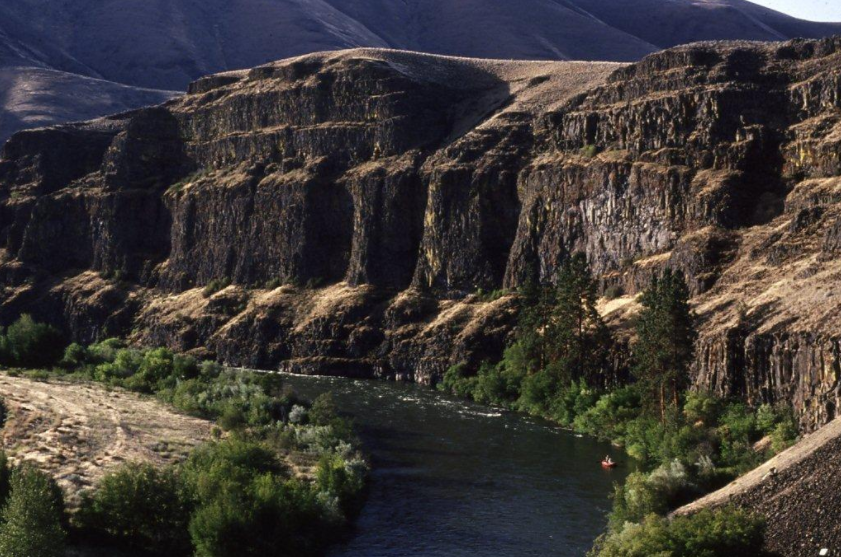
The Yakima Basin is one of Washington’s most ecologically diverse areas, boasting conifer forests, rolling sagebrush hills, basalt cliffs and vital cold water trout and salmon streams, all of it vulnerable to the effects of climate change. YBIP-sanctioned actions that will preserve these lands and their values include:
- The 2013 establishment of the Teanaway Community Forest, 50,241 acres of vital headwaters forest habitat on the Yakima River’s sole undammed tributary.
- Enforcement of a management plan for the Teanaway Community Forest, reducing fire risks and increasing groundwater storage capabilities.
- Designating more than 200 miles of Wild and Scenic river for fisheries, scenic and recreational values.
- Protecting 20,000 acres of endangered shrub-steppe habitat.
- Partnering with tribal and local governments to restore 5,000 acres of floodplain.
- Collaborating with YBIP partners to establish connectivity and wildlife corridors between protected areas.
The Yakima River Basin is already experiencing changes in water supply and availability, driven by climate change. In order for the basin’s fish, families and farms to continue to thrive, managing agencies need to coordinate with other water, fish, agricultural, energy, forest and public health agencies. The Yakima Basin Integrated Plan has forged the partnerships that will make such cooperation possible, while also laying out an adaptive management strategy that improves these organizations’ ability to mitigate the effects of climate change.
Click here for more information on NOAA’s Resiliency toolkit referencing the Yakima Basin Integrated Plan.
Click here for more information on the Yakima Basin Integrated Plan.