

Until now, no phone or tablet app was particularly useful in locating trout streams and finding public access to them.
Enter “TroutRoutes,” an app that maps trout streams in Colorado, Minnesota, Iowa, Wisconsin, South Dakota, Nebraska and North Dakota. Montana, Wyoming and Michigan are on the way.
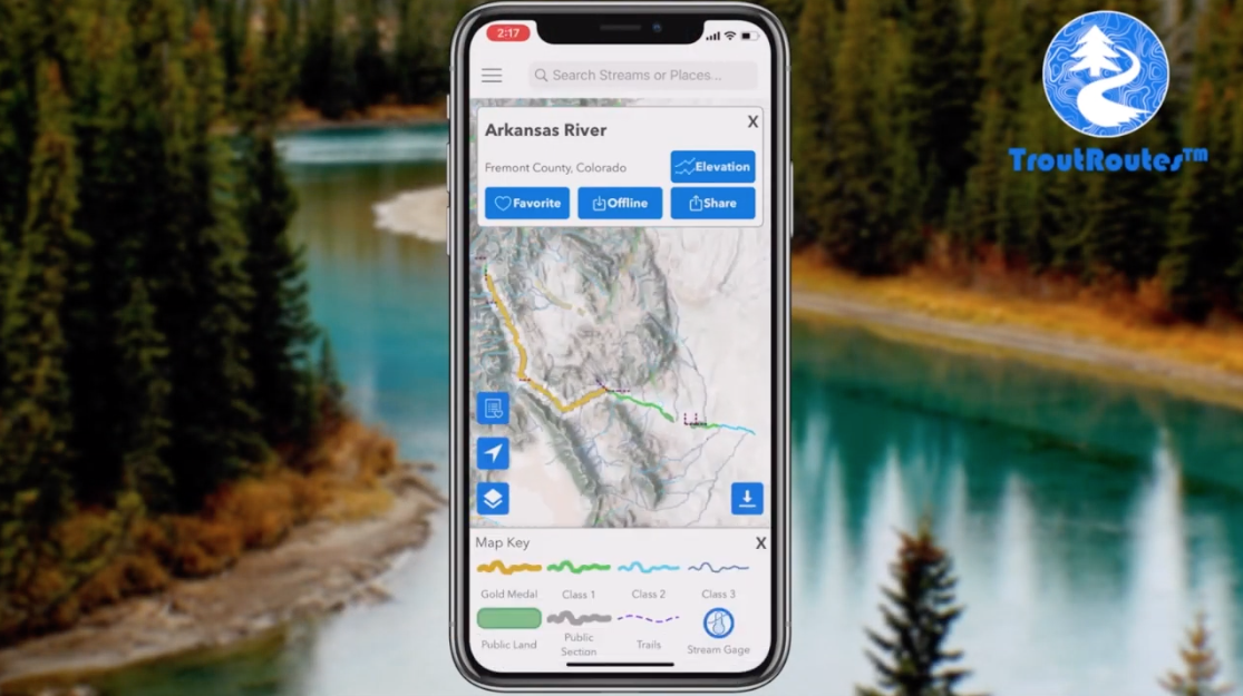
The app claims that there are over 4,000 streams shown on the maps. The app uses the Google maps platform and public data to show every trout stream in these states, together with public lands and public easements. You can also find boat launches, parking areas and even the closest fly shop.
On many streams there is current river gage data. The program allows you to drop pins for favorites and download defined areas for off-line use. You can share locations with friends (presumably, close, tight-lipped friends). The user can toggle between road maps, topography and satellite views, among others. The maps will show you elevation at any point along the river.
I and a couple of my friends have used the program for many months now and it has been extraordinarily useful in finding public water in our home states of Wisconsin and Minnesota. I love exploring new water and I have recently found a couple of hidden jewels that are not well known, require a bit of a hike, but are well worthwhile.
The search function of the program can be a little frustrating, because it is tied to nationwide Google places. For example, when you search “White River,” you get several listings in the search bar even though not all of them will be on the available maps. If you are only slightly creative in your searching, you can easily find the river you want.
There is a free version of the app, showing all the trout streams, but this version will not show you public access or certain other features. The Pro Version offers a seven-day free trial and requires a $40 yearly fee to give you full functionality.
— Jon Christiansen