

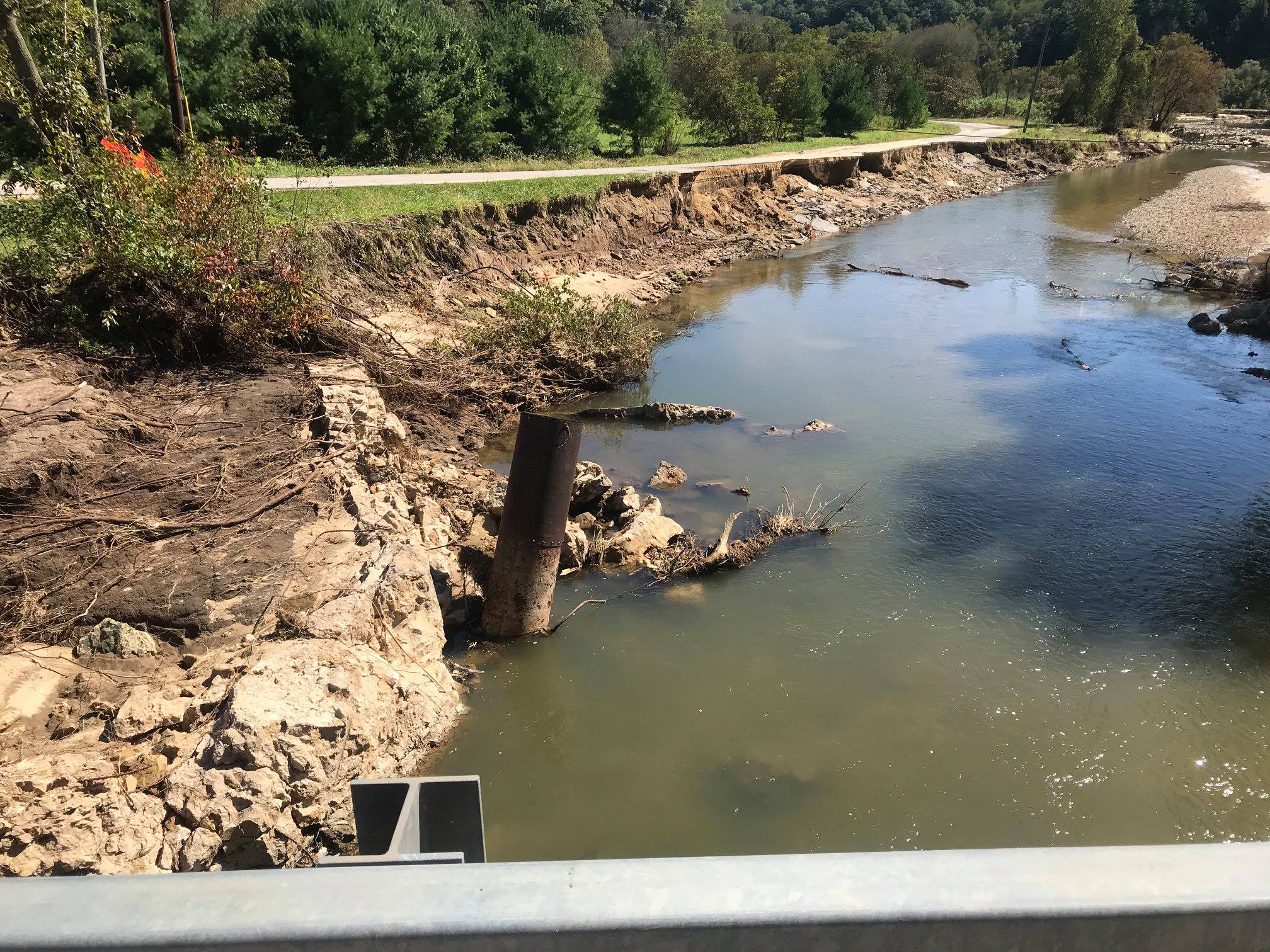
The view of West Fork downstream from Highway S bridge at Bloomingdale Road.
Duke Welter
Now that much of the high water from the recent heavy rains in the Driftless Area has receded, it’s possible to assess the damage.
Plenty of ink and pixels have been devoted to telling the human story of loss and hundreds of rescues, and the determination of residents to rebuild.
We took a tour this week of the Coon Creek, West Fork and Upper Kickapoo watersheds, maneuvering around bridges under repair and through roads recently cleared of mudslides. Here is a summary.
The heaviest impacts of the two rainstorms (on August 27-29 and September 2-4) generally followed Highway 33 from north of Coon Valley to Cashton, Hillsboro and Readsburg. But they were not a narrow band. While Ontario received 15.57 inches of rain between August 26 and September 3, Westby got over 18, Elroy over 23 inches and Readstown 11.56, according to the National Weather Service.
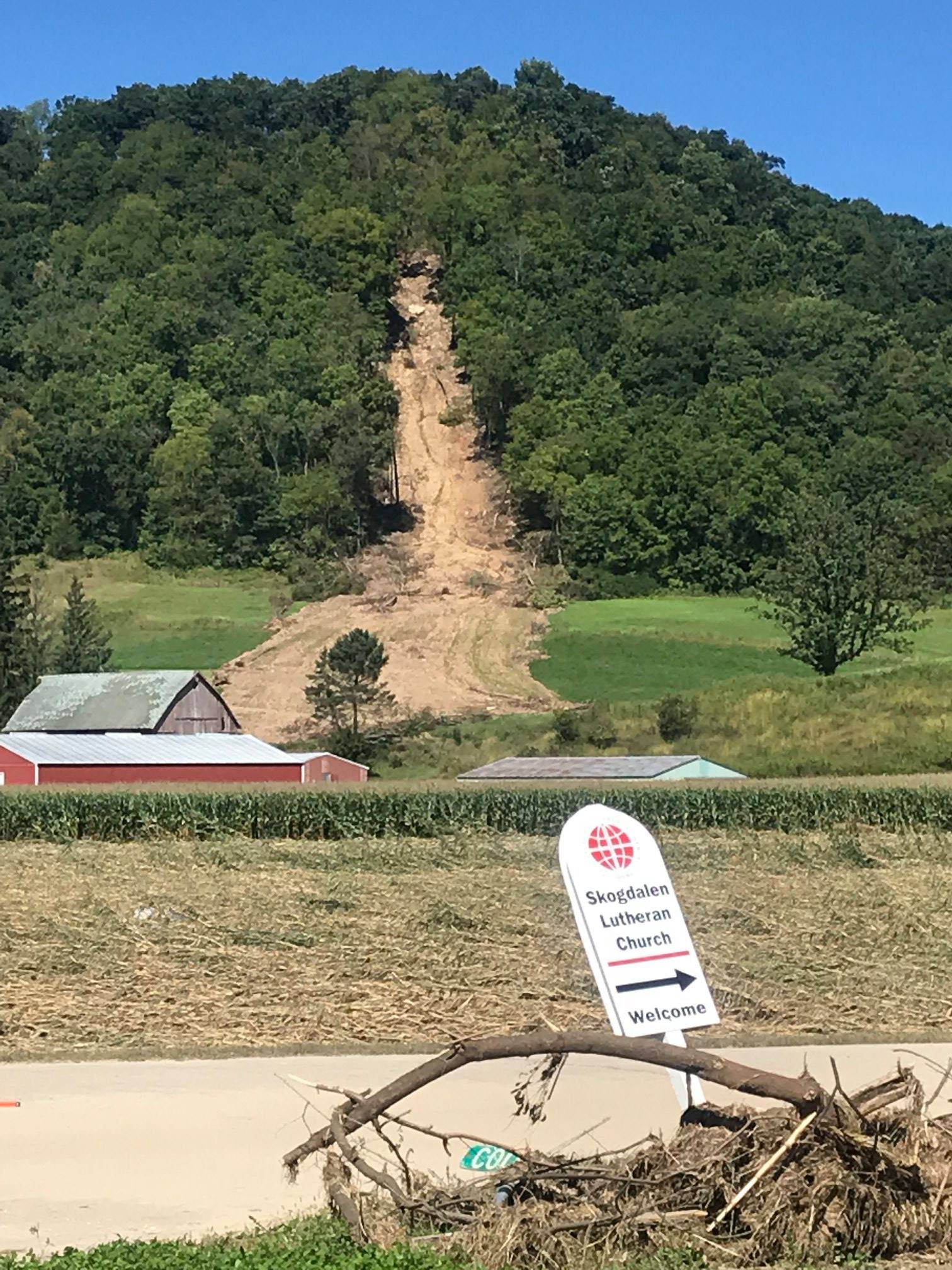 Heavy rains created this mudslide above Skogdalen Lutheran Church.
All that rain created a strain on the river systems draining the area, and on the flood-control dams higher up in the drainages.
Six of those dams failed and other suffered damage. When they failed, as in the case of one in the Upper Rullands Coulee drainage, they sent big slugs of water and caused big damage.
Rullands Coulee is a mess, with barn and shed parts scattered across the landscape, and tipped-over gravestones at the Skogsdalen Lutheran Church.
 Prior to flooding, a barn and shed flanked this silo.
For many years, the late Palmer Olson had a small fly shop along Rullands, with a pond from an impounded spring where he would cast nearly every day. That pond’s berms are gone, and his house sits cantilevered over an undercutting bank.
A tree slide on the ridge to the north of Rullands at County Highway P and Oakdale Avenue brought trees and mud 350 feet down a swath of hillside. Where box elders edged the stream, many were torn out and washed down into Timber Coulee where the stream is widened and shallow for some distance below the Highway P bridge.
The confluence of Rullands and Timber coulees.
Some older restoration work in Timber Coulee (from the 1970s and 1980s) failed below the confluence, as did some older work on Bohemian Valley.
It might be a good time to consider reworking affected areas of Timber and Bohemian Valley. And these results should prompt some questioning of the efficacy of doing restoration work in tighter upper valleys with high gradients. It may be more useful to focus restoration efforts on middle reaches of valleys, where floodwaters have lost some of their force.
Two dams failed in the West Fork of the Kickapoo River (notably the Jersey Valley Dam, where repairs cost $3 million a half-dozen years ago), causing significant damage to the West Fork Sports Club and upstream restoration. Those damages could be repaired, however.
More recent restorations on lower Timber and lower Spring Coulees, however, appear to have weathered the storms well.
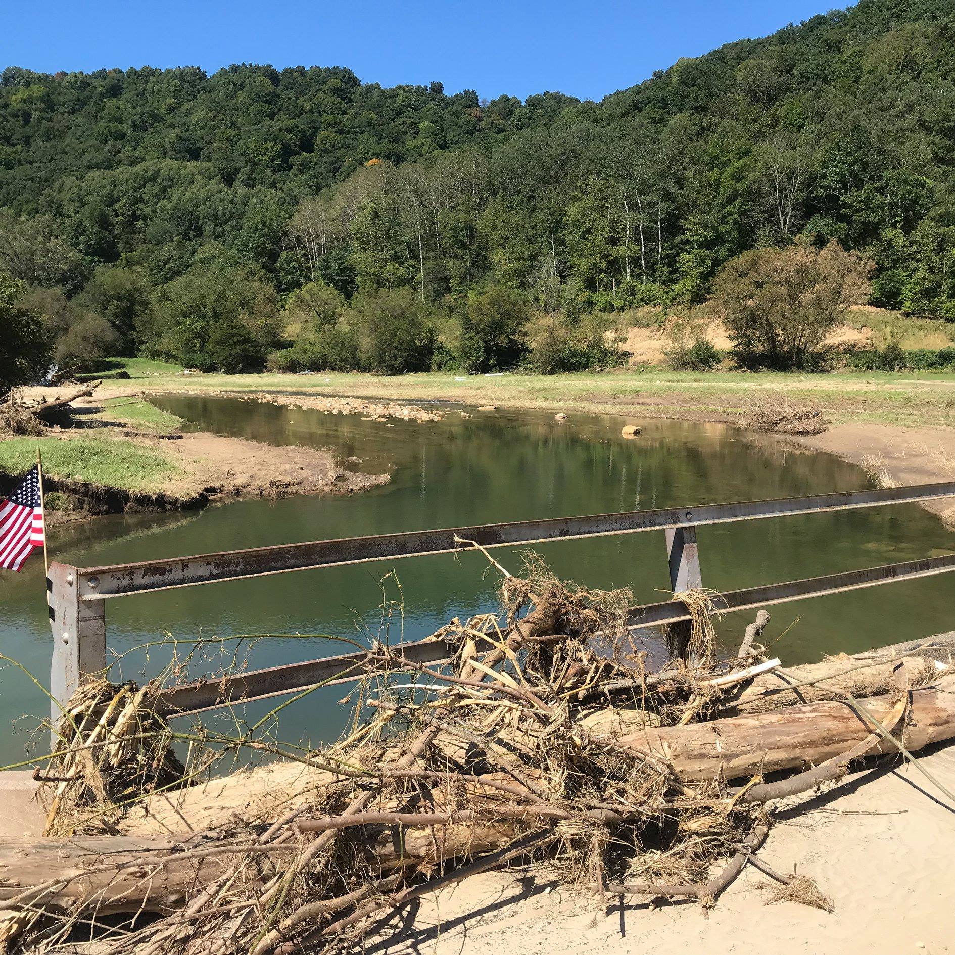
Rullands Coulee horse pasture looking downstream from Oakland Road bridge. This water averaged 8 feet in width a month ago.
The Bob Jackson and Neperud properties are in excellent shape.
Snowflake Ski Club’s property on upper Timber Coulee took some serious hits.
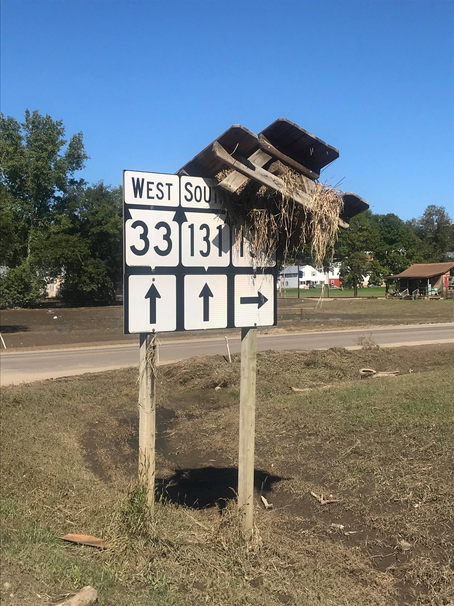
At Ontario, the main stem of the Kickapoo flooded, leaving a picnic table perched atop a 9-foot highway sign.
Farther down the Kickapoo, towns from La Farge to Gays Mills flooded twice. Tributary streams, however, seemed to be undamaged other than Brush Creek west of Ontario.
The Weister Creek project north of La Farge was unmarked by the high water.
Readstown suffered badly, with most of the houses in the flood plain partly submerged. A resident paddled his kayak out to check his and his mother’s homes. Both were total losses.
Continuing a pattern seen in recent storms, it appears dry runs brought significant amounts of cobble down hillsides and into yards and stream corridors. Many homes were historically built in little nooks along the edges of the bluffs. Those are funnels for the dry runs, and homes showed significant damage even if they weren’t located in or near flood plains.
Duke Welter is the outreach coordinator for the Trout Unlimited Driftless Area Restoration Effort.