For good or ill, nick points change rivers, sometimes forever
To put my amateur science skills on full display, I’ve always associated the term with the sins humans have committed against rivers. We built our structures too close, grazed and beat down their banks. We diverted their flows, channelized and dammed them until they were forced to remind us, often quite impolitely, that they would not be so easily controlled.
In the view of actual science, “nick point” is simply a sharp change in the long profile slope of a river channel. Nick points are places of active erosion. A herd of ungulates drinks at the same spot. As they mill about, they dislodge and compact the ground, causing a localized drop in elevation relative to a point just above, say, where the animals are fenced away from the stream. A pour over develops and eventually, a small waterfall or “headcut.”
The erosive force of free-falling water causes the cut to cave in on itself, which it does over and over again as it marches upstream. Throughout this incision process, the elevation of the downstream channel becomes the water table.
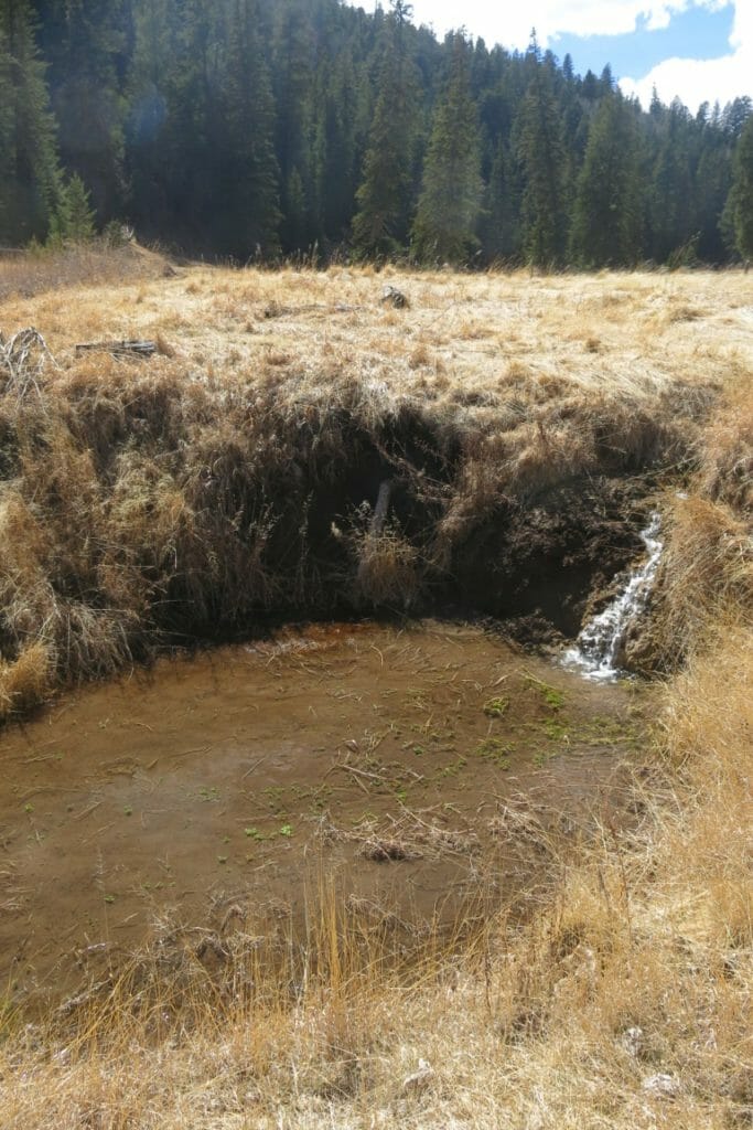
In New Mexico, this dynamic is instructive in two ways. First, since the advent of intrusive and extractive land use — grazing, beaver trapping, logging, mining, urban development and the roads we built to enable it all— many of our streams have downcut to the point where they now flow underground.
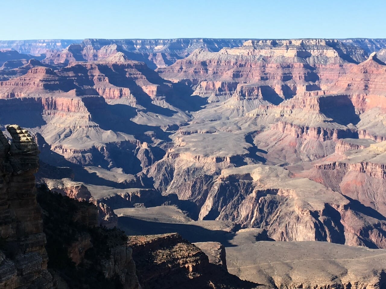
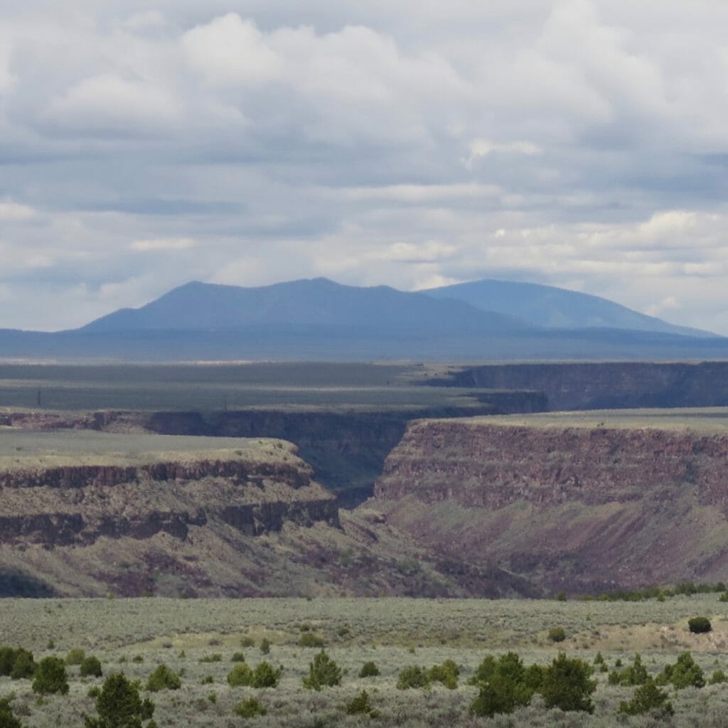
The second thing to recognize is that nick points and their erosive consequences occur everywhere in nature. Glacier-made Niagra Falls and the tectonically busy Rio Grande Gorge are both nick points. On a smaller scale, the log jammed across a channel might become one, or a landslide boulder rolling to rest mid-stream. In fact we owe so much of our landscapes’ diversity and beauty, indeed their function, to nick points.
Where conditions and space allow, a river will easily accommodate abrupt changes in channel slope. An Alaskan wilderness river, with its endless floodplain, wetlands, and seep ponds, is almost nothing but active and absorbed nick points, banks gouged out by spring’s flow of ice chunks, house-sized piles of trees and roots forcing the river to choose left, right, or down, and more often than not, the river chooses all three.
From an aerial perspective, all this violence makes perfect sense. The river’s random wander resolves into an almost divine organization. There’s a naturally established rhythm to the spacing of meanders in the river of today, and in the trails its former selves have left in the floodplain grass. The salmon thrive from all of this, and so the grizzly and Dolly Varden grow fat.
Resiliency is a self-organizing system’s capacity to absorb disturbance and keep functioning the way it did before. In retaining its function, the Alaskan system retains its identity. Similarly, most New Mexican streams historically flowed out of big mountain chains, then crawled long distances across flat, arid terrain without contributions from other streams. They relied on healthy riparian zones — assemblages of grasses, forbs, and trees — to incorporate nick points into their ecosystems. They relied on beavers, predator-regulated grazing and the occasional fire or flood, thus remaining wet en route to larger rivers.
Human disturbances over the centuries (mainly the late 19th and early 20th) have compounded to change components and processes to the point of actually changing the identity of today’s typical New Mexican stream. In their lower reaches, the “functions” of rivers like the Costilla and Galisteo don’t include flowing water and organisms such as trout, and haven’t for some time; according to resilience thinking, a threshold has been crossed with no possibility of return.
Yet insofar as they absorb disturbance (flash floods, further erosional incision) and maintain their current function of supporting fewer but dryland-adapted plant and animal species, the Costilla and Galisteo are resilient. They’re just resilient in a different ways than they used to be.
It’s good to remember that nickpoints and concepts like resilience do not play favorites. They are simply forces of nature that, most of the time anyway, are beyond our control. I write this not to wave my white flag to these current awful times, but to remind myself to focus on what is within our control.
Which is to say math. Measurements of ground cover, species density and diversity, inches of lift in the riparian water table or, if you prefer, gallons of attenuated peak flow. Ratios, depth-to-width, riffle-to-pool, renewable to non-renewable energy. Minutes of riparian shade, miles of stream reconnected. Headcuts repaired. Restoration jobs created, hunting and fishing licenses sold. Feet of physical separation between guide and client. Purchases made locally versus over the internet.
My point is that there are objective markers for where we are and where we need to be. We can measure and we can act.
Then there’s love. For the soil we walk on, the food we eat, the songs and sights that make us happy. For mountains and for rivers. And for trout, my line of separation between a world I want to live in and the void. We can, and must, work to absorb disturbance. We must work maintain function.
Toner Mitchell is TU’s water and habitat coordinator for New Mexico. He lives and works in Santa Fe.