Our public lands are the foundation of healthy watersheds and strong communities. From remote trout streams to working forests and rangelands, these places provide clean water, vital trout habitat and public access for all Americans. But pressures like efforts to sell off and privatize public land threaten what makes them so valuable.
This blog series highlights the people and places at the heart of these landscapes—and the practical, local perspectives keeping them accessible, productive and resilient for generations to come.
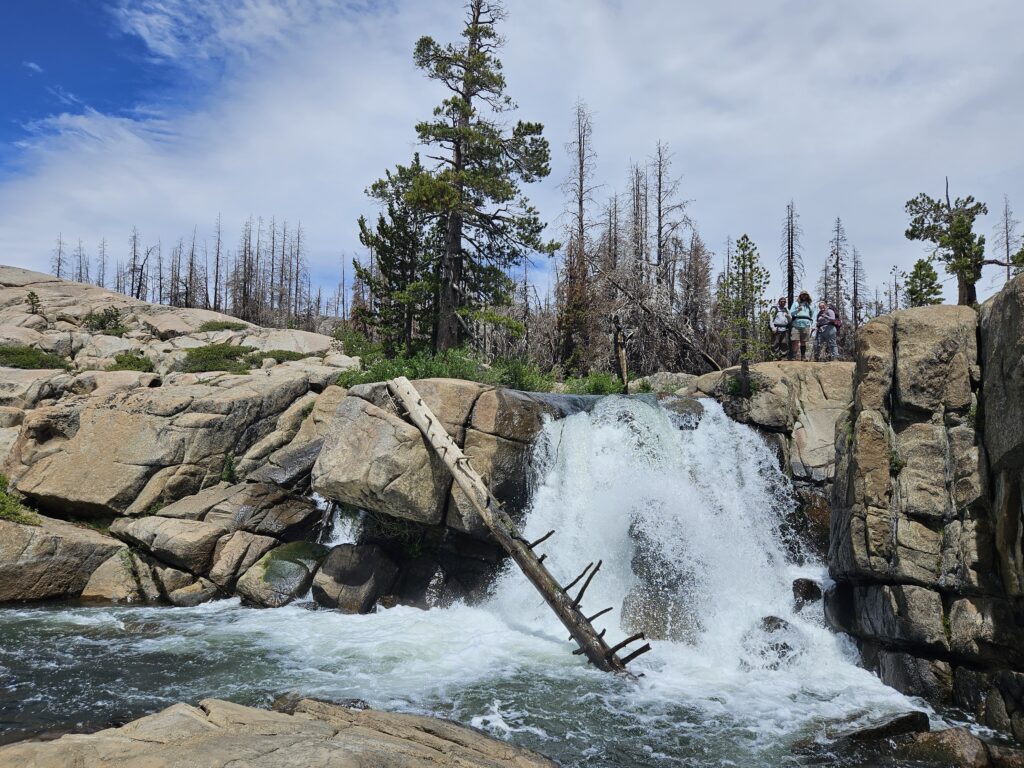
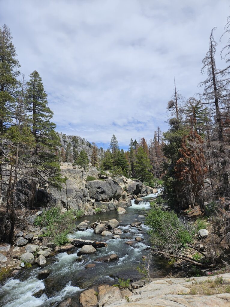
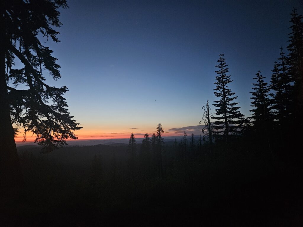
Located south of Lake Tahoe in California’s Sierra Nevada range, a state-designated wild trout stream flows from Caples Lake before joining the American River on its journey to the Pacific Ocean. One of the qualities that makes Caples Creek productive for trout—and fishing—is its location: it flows entirely within an Inventoried Roadless Area (IRA) in the Eldorado National Forest.
The striking, granite-flecked landscape of the Caples Creek Roadless Area provides recreational opportunities for hikers, mountain bikers, hunters, and, in my case, anglers seeking native and wild trout.
Values of roadless areas
Roadless areas are portions of national forests that are unroaded, typically because they are remote, very rugged, or otherwise have little timber value. These areas provide irreplaceable fish and wildlife habitat and offer hunting and angling opportunities to all Americans. Driven in part by the huge cost of maintaining the more than 370,000 miles of roads already on our national forests, the U.S. Forest Service adopted a rule in 2001 to keep Roadless Areas in largely natural condition.
Under the Roadless Area Conservation Rule, creation of new roads and industrial-scale logging are generally prohibited. However, Roadless Areas are open to many other uses, including habitat improvement projects, mining development, grazing and hazardous fuels work to reduce catastrophic wildfire risk.
In fact, the Caples Creek Roadless Area provides a good example of the benefits of fuels treatment projects in Roadless Areas.
Managing fuels helps prevent greater destruction
In 2019, the Eldorado National Forest completed the Caples Ecological Restoration Project. Over three years, 8,800 acres of this roadless area were treated with prescribed burning to remove buildup of the forest understory.
In 2021, fire met this landscape again during the devastating Caldor Fire, which raged across the Sierra Nevada for 69 days, burning over 220,000 acres and destroying more than 1,000 structures. In a heroic effort by several fire agencies, forward progress stopped on this human-caused blaze just before the community of South Lake Tahoe.

Caples Creek is one of the home waters of the El Dorado Chapter of Trout Unlimited; one that they have been heavily invested in for decades. Once the fire was out, chapter leaders and members were eager to see what impact the Caldor Fire had had on the watershed. In the Winter of 2022, they worked with TU staff to gather existing data on the stream and coordinate a survey of the entire system. In July of 2023, a four-person team of TU researchers set out to assess the current condition of Caples Creek.
On the hunt for trout and good habitat
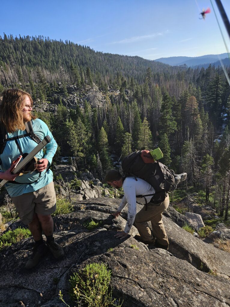
This team hiked upstream along the entirety of the creek and log GPS, visual and annotated data on meadow health, habitat complexity, sedimentation and other values. Team members also took turns fishing the creek, while the rest of the crew collected data.
Initial Google Earth scouting revealed that the majority of the trip would be off trail with several canyons and waterfalls to navigate. Anticipating a high accumulation of deadfall in the wake of the fire and high flows from a late runoff, surveying progress slowed.
The terrain proved exceptionally difficult to navigate, and morning light of the third day found our crew sitting on a tailgate next to the dam on Caples Lake stretching sore muscles and preparing a different approach to the survey.
The night before consisted of a six-mile evacuation, a two-hour hitchhike back to the trailhead and a short, restless night of sleep in the parking lot. After two days of trudging up the deadfall choked creek, our crew encountered a series of raging stream crossings. After successfully fording two of them, we became trapped between a deeper, more violent stream crossing and a 100-foot canyon. Safety dictated a retreat, so we turned back. We spent significant time and effort to document conditions on only 75 percent of the stream.
Through a combination of determination, a Garmin inReach, a team of generous researchers from UC Davis with a vehicle and support from other TU staff, we reset for the third day. We hiked downstream from the dam to survey a new section and complete the survey.
A healthy river thanks to prescribed burns
The complied data lives in a public Google Earth Tour.
Surprisingly, our data indicated that Caples Creek is a healthy, dynamic river and responded well to the ravages of the Caldor Fire. This report from the Sierra Nevada Conservancy noted that
The Caples Project was one of the largest treated areas in the Caldor Fire burn area. While the edges of the Caples Project burned, the project landscape as a whole was resilient, despite the extreme heat and drought of the 2021 fire season. It was a rare place in the wildland where the fire slowed down and changed course, even as high winds drove it up and over the crest of the Sierra Nevada.
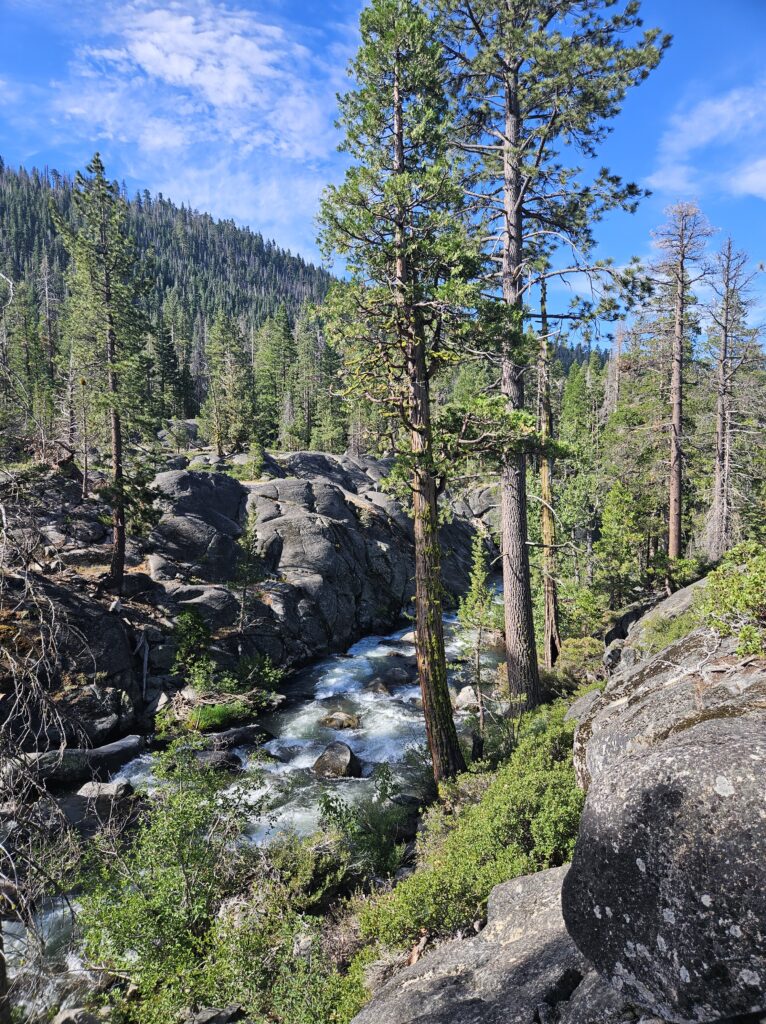
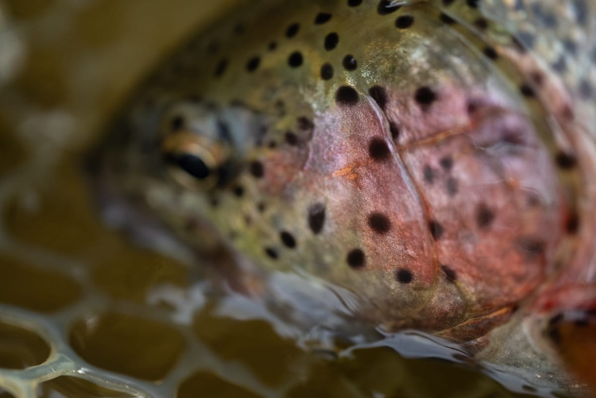
During our survey, we found very few places where sediment input appeared excessive, and for the most part, the amount of sediment and structure found in the creek appeared to provide good to excellent habitat conditions for trout.
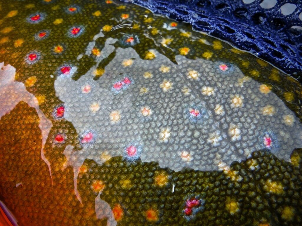
The many log jams we documented provided fantastic fish habitat, and in some cases were even pushing water into older, previously disconnected oxbows. Sediment deposition took place in pocket floodplains where a healthy riparian buffer continues to form. We saw—and caught—many trout around log jams. The lower part of the reach contained exclusively wild rainbow trout, while the upper third of the stream hosted wild brook trout.
Conditions on Caples Creek will continue to change for a number of years. Long-term monitoring is planned to evaluate the health of the fishery—and TU will continue to play an important role in that effort, but multiple sources report that past fuels reduction projects significantly mitigated damage from the fire.
Without Roadless Areas our native and wild trout are unlikely to continue to thrive as they have in the Caples Creek Roadless Area. And without the ability to mitigate catastrophic wildfires with prescribed burns in these areas, trout habitat loss could be devastating.