
Editor’s Note: The Strawbridge family from Lakeland, Fla., is hiking the length of the Continental Divide Trail – all 3,100 miles of it – from Canada to Mexico. Henry Strawbridge, 14, will be providing updates of their journey to Trout Unlimited as they pass through the historic range of seven native trout species. You can track the family and see reports submitted by Henry on this map.
By Henry Strawbridge
On the last day of the section from Leadore, Idaho, to Lima, Mont., there is a stretch of the Continental Divide Trail known by thru-hikers as “The Roller Coaster.” We found out why.
But, back to the start. After a half day of good rest, Sam, the owner of Leadore Inn, dropped us off at the trailhead around 4 p.m. We began with a run from a very dark cloud behind us and set up camp right before the rain caught us.
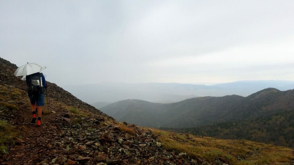
In the morning we began a climb that would take us up to 10,125 feet, the highest point of the trip so far. As we neared the top of the climb, the rain poured down. Thankfully there was no lightning, because we were out in the open. The rain didn’t let up until a little after noon, and even then, it wasn’t finished. We could see for miles and felt sorry for any hikers that might be to the north of us. It looked like it was coming down a lot harder in that direction.
Once we were up high, the walking was easy. It was relatively flat and we were able to cover some good miles.
We had come into cattle country, and saw several large herds, and the many tracks and disturbances they left behind. We also saw a little black bear running away from the place we were planning to camp.
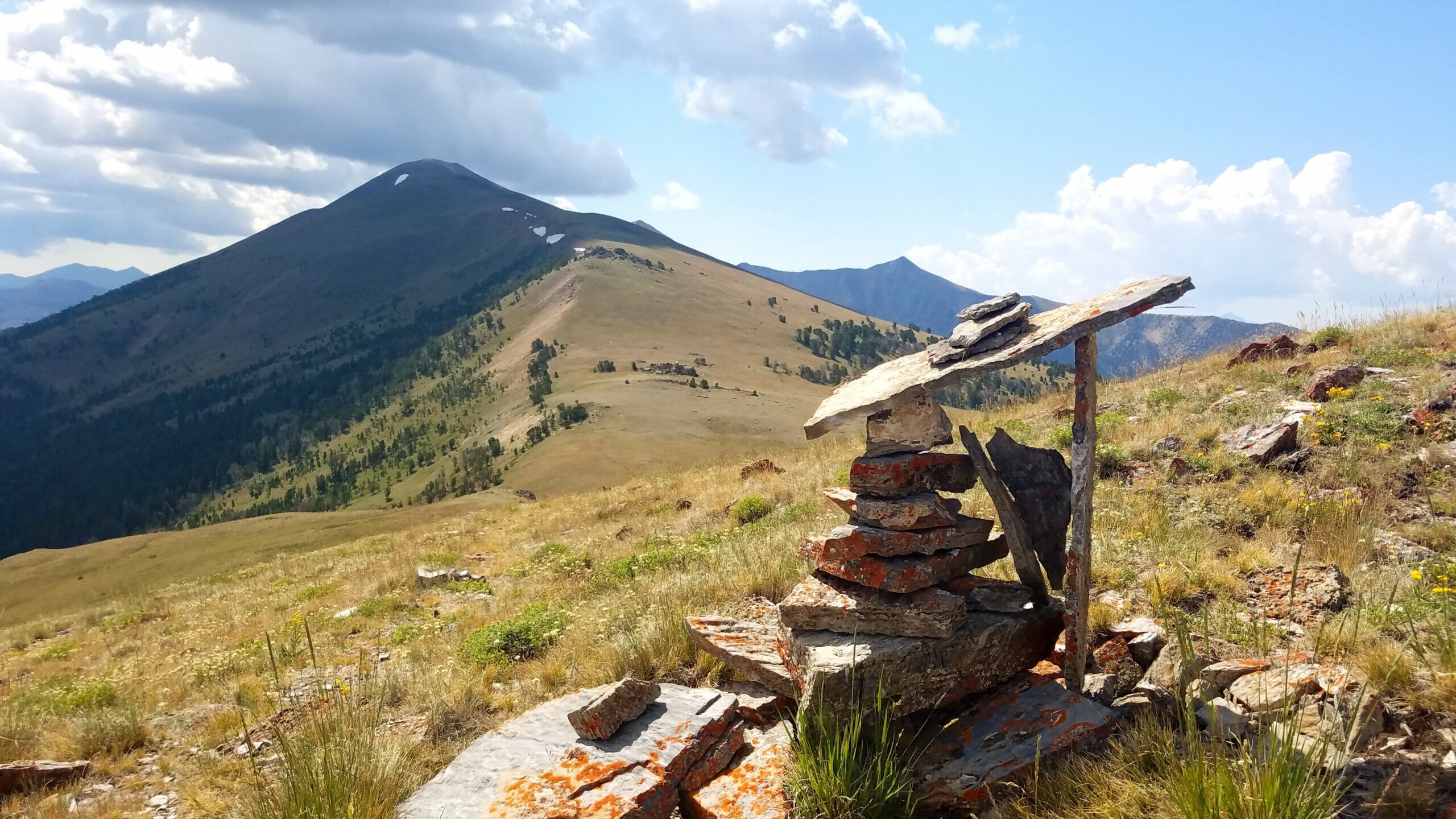
From the very first day of this section, we could see all the way to where we would be in three days. Across a wide, high desert valley we could see a pass that we would eventually cross over to stay on the divide. To our right and in front of us there was a mountain range that the CDT climbs up into twice.
That second day, excited about spotting a shortcut, I opened my navigation app called Guthooks. I pointed out to my parents that there was a road that stayed down just underneath the mountains for about 25 miles while the CDT weaved up into the mountains for about 65 miles before dropping back down to the road. I suggested we hike along the road to get there faster, but mom decided we should stick to the trail. Dad decided not to back me up.
We climbed up a fairly well marked trail for about three miles, but then the trail became hard to follow and we got lost twice. One of the times I followed an elk trail around the side of a ridge and it got pretty scary before I figured it out. Our only way to navigate was to follow cairns and posts, about half of which were blown over. We climbed over ridges with no visible foot path. It was steep up, steep down, and we only made eight miles before lunch. It was our worst morning yet. Mom even admitted she would have preferred the road.
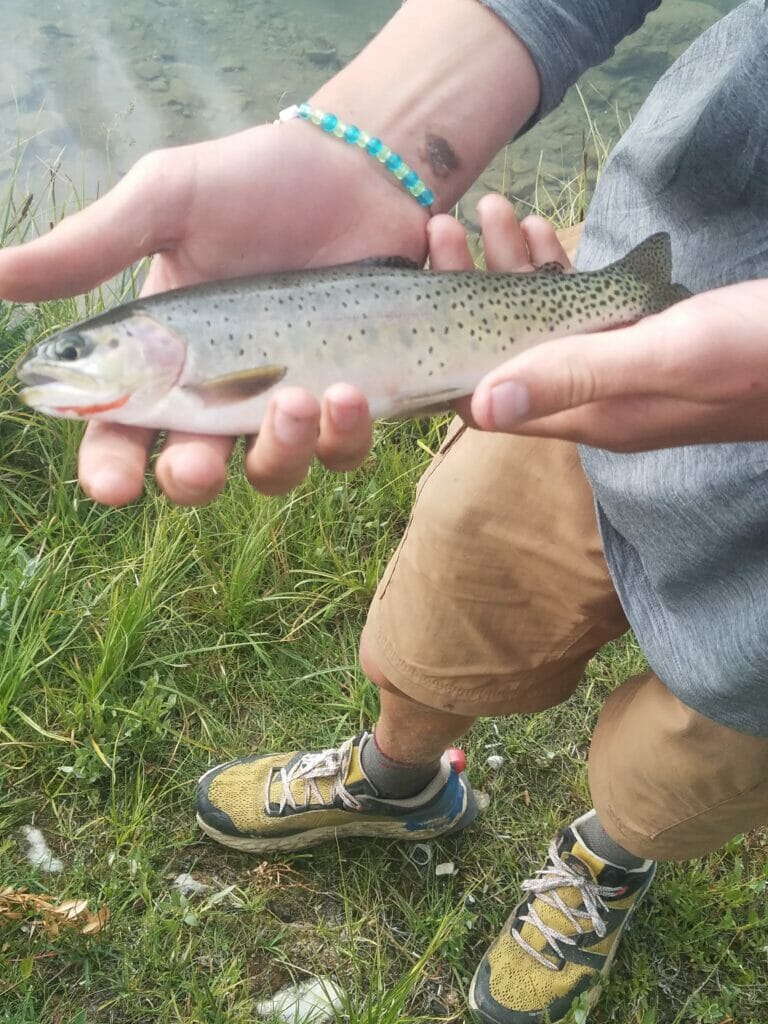
The next day, though, we had an incredibly easy time. We walked seven miles of flat before finding a road that cut off 5 miles. I ended that day catching a beautiful cutthroat trout in Deadman’s Lake.
The fourth day was also very easy except for a long water carry. The reason we had a long water carry was because the cows had destroyed one of our potential sources. Other than that, the day was uneventful, but the day after, I’ll never forget.
Before I tell you about this day, I want to mention again that there was a road that cut across a valley straight for the interstate near Lima.
On the map it looked like any other climb, and it began with some nice walking. I was preparing mentally for a big climb, various thoughts passing through my mind
“Uh oh! We’re off trail, we need to be up there!”
“Let’s follow this elk trail!”
“This is steep! Finally, the trail!”
“The trail is still going up? Ugh, this is so hard!”
“Almost there!”
“Made it!”
“It’s going to be easy after this! It’s basically all downhill. We’ll be there in no time!”
I’m sorry to say we were mistaken. Those little pops, as we call them, drawn on our Guthooks map were nothing to the massive ridges we saw on the trail ahead of us.
Oh well, there was nothing to do but go ahead and climb them. There’s no easy way back to that road now. Seven miles before lunch … seven long, hard, hot, grueling miles.
“Short lunch today, or we won’t make it to town. Seven more miles, of this and then it’s “real” down.
We made the remaining 17 miles by 6:30 p.m.
I sat on my backpack, waiting for the others, in the shade of an interstate underpass with sore legs, ready for a good night in Lima. A burger and a place to lay down would be just what I would need.
That was the first time in my life I didn’t like a roller coaster.
Until next time,
Henry
COVID-19 note: The Strawbridge family anxiously watched as the coronavirus issue threatened their plans to do the CDT this year. After careful consideration the family made the decision to drive to Montana to start the trip to avoid any possible exposure on airplanes. None of the family members are exhibiting symptoms. They will continue with limited contact with the outside world throughout the duration of the trip.