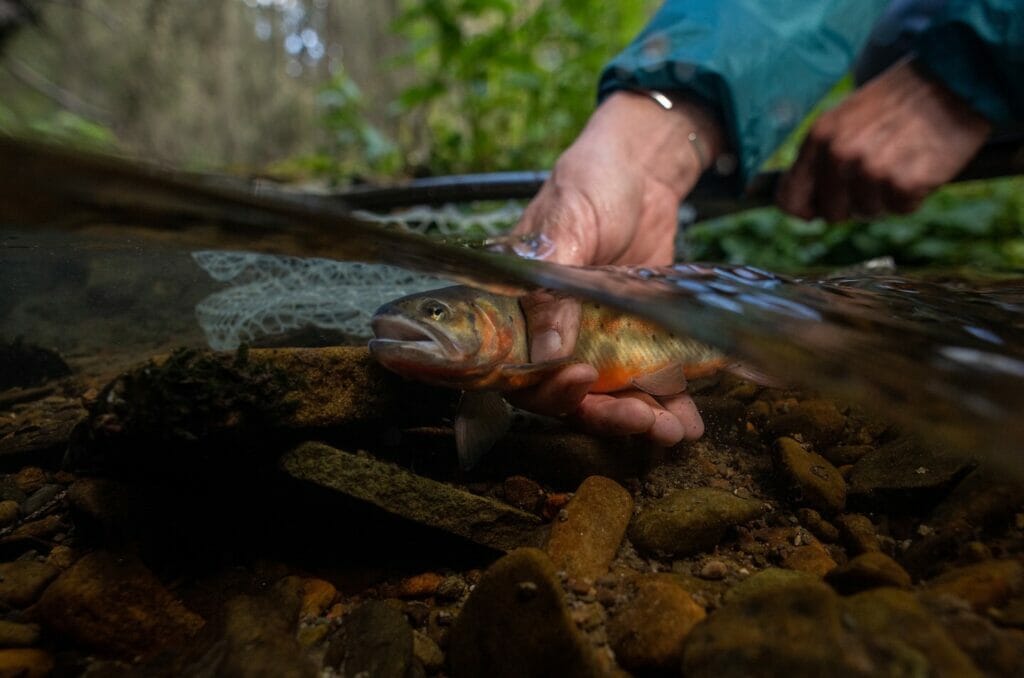
Picturing somebody standing in a river staring at a fish while wearing a white lab coat and protective goggles for no reason might be what people think of when they hear the title Trout Unlimited scientist.
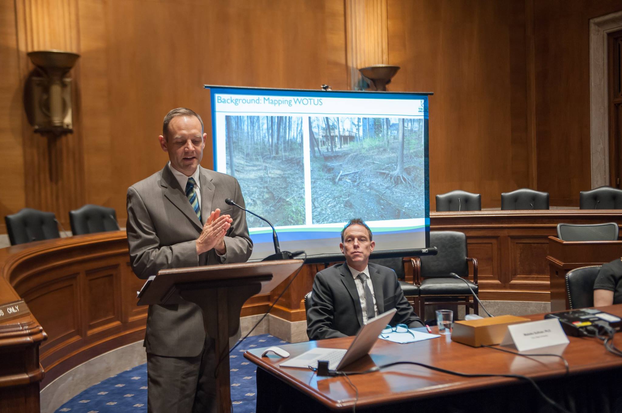
While there is an outside chance that might happen, in reality the 30 or so TU staff with a science background are more likely to be standing in a state capitol or the halls of Congress armed with important data capable of influencing lawmakers, agency staffers and, eventually, environmental policy.
“In lobbying advocacy, you have just a minute or two to make a point. If you can’t do it effectively in that time you are done and out,” said Steve Moyer, TU’s vice president of government affairs. “The TU Science team gives us the opportunity to make that first meeting count by providing credible, accurate and effective messaging. I’ve seen it over and over, particularly with Waters of the United States.”
For those unfamiliar, Waters of the United States — often referred to as WOTUS — are the streams, waterbodies and wetlands which fall under regulatory jurisdiction of the Clean Water Act. In January 2020 the Environmental Protection Agency and U.S. Army Corps of Engineers released the Navigable Waters Protection Rule, redefining what waterways are covered by Clean Water Act protections.
https://www.tu.org/blog/changes-to-the-clean-water-rule-whats-at-stake-on-the-ground/
A particular concern to Trout Unlimited was the removal of ephemeral streams, which only flow in direct response to precipitation events like heavy rain and snow melt.
Providing data and backing it up
Studies have shown these part-time headwaters are vital to downstream water quality, and irreplaceable resources for fish. The small, seasonal streams also play a role in flood risk reduction. The 2020 announcement took away the need for a federal permit to dredge, fill or discharge pollutants in ephemeral stream channels — naturally, TU opposed this rule change, and we’re still working to fix this issue from a policy perspective.
The federal agencies announced the decision and concluded mapping limitations prevented any attempt at quantifying the extent, distribution or abundance of the affected streams. This claim is somewhat like a child proclaiming he or she can’t ride a bicycle without ever trying. Trout Unlimited, the National Wildlife Federation and a former director of the U.S. Fish and Wildlife Service said as much in a New York Times opinion piece.
A number of approaches for estimating ephemeral stream abundance were, in fact, widely available.
The Trout Unlimited Science Team, led by Kurt Fesenmyer, and collaborators at the University of Georgia started gathering map data in 2018 when the current administration announced it was going to repeal and replace the Clean Water Rule, specifically the Obama-era WOTUS definition that covered ephemeral streams. The team quickly identified an approach for estimating the extent of affected streams using the best available national stream maps and a simple method predicting the location of unmapped stream channels and then created new maps. The data was available, despite the federal agencies saying otherwise, when the Navigable Waters Protection Rule was announced earlier this year.
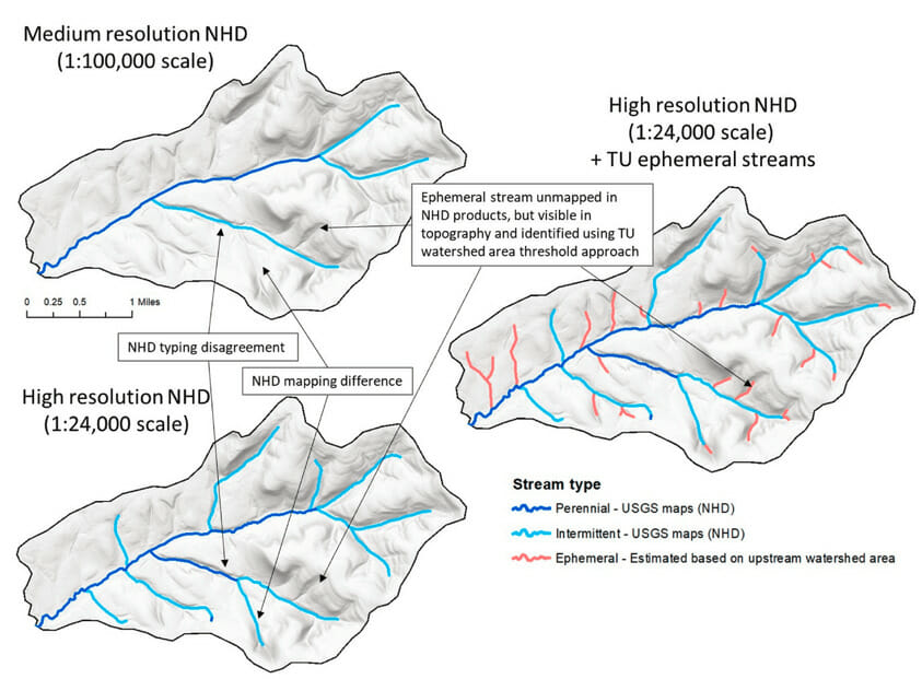
“Our research estimates that between 43–56 percent of stream channels by length in the lower 48 states are ephemeral and half will lose Clean Water Act protection under the new rule,” said, Fesenmyer, who works as the GIS and conservation planning director at TU. “In western states, where ephemeral features are more abundant, the amount of streams impacted by the rule is likely greater.”
The EPA already estimates nearly half the streams in the United States are in poor biological condition, and the loss of protection of ephemeral streams will obviously exacerbate those conditions. The ability to map ephemeral streams provides a means to determine possible waterway impacts from development projects like oil and gas pads to big-box store parking lots on more than 6 million miles of stream across our country.
“This research has helped quantify the impact of the Navigable Waters Protection Rule and will provide important evidence in ongoing litigation, showing that the ill-informed rule was not thoroughly evaluated,” Fesenmyer said. “It will also support the ongoing efforts of Trout Unlimited and its partners to find a legislative solution to the repeatedly changing administration rules for defining the waters subject to the Clean Water Act.”
Maps have many uses
TU isn’t only sharing map products in Washington, D.C. Around the West our staff is showing important work with land managers, politicians and other conservation groups.
Trout Unlimited’s critical minerals campaign has shown roughly half the known critical mineral deposits are in trout and salmon habitat.
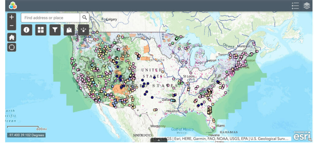
The Science Team also helped produce a speculative leasing web app to help identify locations that should never show up as leasing locations because the land has low oil and gas potential.
Another example is the Upper Rio Grande Basin Initiative focused on Rio Grande cutthroat trout in southern Colorado and northern New Mexico. TU science staffers have provided mapping tools and analyzed stronghold Rio Grande cutthroat trout populations in the basin. The effort helps TU with fundraising for the future and is an important part of our Protect, Reconnect, Restore and Sustain conservation model.
“Sound science is essential to advancing TU’s advocacy work in the West,” said Steve Kandell, director of Trout Unlimited’s Anglers’ Conservation Project. “It informs decision makers as to where, how and when TU engages on policy issues important to protecting trout and salmon habitat.”
Brett Prettyman is the communications lead for Trout Unlimited’s Science Program. He is based out of Salt Lake City. Reach him by email.
The TU Science Week Schedule
Monday, Oct. 19 — Helen Neville, Trout Unlimited’s senior scientist, talked about how science is used by TU across the country on Instagram Live. We also released a blog from Helen explaining how science makes conservation credible.
Tuesday, Oct. 20 — TU premiered “Lahontan: A Trout Unlimited Science Story”. Jason Barnes, Trout Unlimited’s Lahontan cutthroat trout biologist/coordinator, joined TU filmmaker Josh Duplechian on Instagram Live. Jason wrote a story about his work and the filming of the movie.
Wednesday, Oct. 21 — Steve Moyer, vice president of government affairs at Trout Unlimited, will be on Instagram Live at 2 p.m. ET, to talk about the role science plays in the organization’s efforts to engage in policies important to our mission. For example, EPA officials said mapping of ephemeral streams could not be done, but TU’s Kurt Fesenmyer of the TU Science Team proved them wrong and showed how numerous the important “part-time” streams are across our country with GIS mapping technology. A blog with the same theme will hit social media the same day.
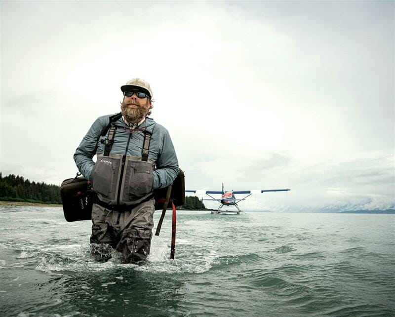
Thursday, Oct. 22 – Our second science film premier of the week is called “Anadromous Waters” and features the impressive work of TU staffer Mark Hieronymus as he seeks to find Alaska rivers not previously documented as holding steelhead and salmon. The state estimates only half of the waters holding anadromous species have been identified. Hieronymus will be joined by filmmaker Josh Duplechian on Instagram Live at 6 p.m. ET. The film will launch at 7 p.m. ET. Hieronymus will also write about his work in a blog released that day.
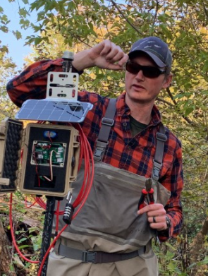
Friday, Oct. 23 — The TU Science team includes staffers with backgrounds outside the realm of traditional research science. Community science efforts take place around the country. Jake Lemon, TU’s eastern angler science coordinator, works with volunteers and partners on various projects, including deployment of Mayfly Sensor Stations, which TU member volunteers set up to provide real-time access to current stream conditions. Jake will be on Instagram Live at 3 p.m. ET. to talk about Mayfly Sensor Stations and other technologies being used for conservation work in the East, including volunteer stream monitoring programs, sampling eDNA to identify undocumented wild trout populations and using drones with infrared sensors to map stream water temperatures .